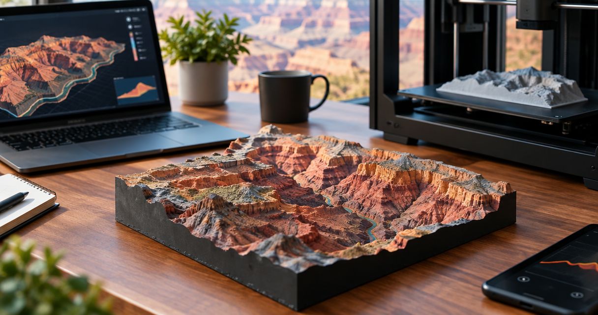
Yes, you can 3D print a map of the Grand Canyon rim-to-rim hike by combining a GPS route with a printable terrain model. The key distinction is that a GPX track describes your path, not the canyon’s surrounding surface, so a topographic keepsake needs both route data and terrain data. For a 2026 hike, use the route you actually completed rather than assuming every rim-to-rim crossing follows the same trail.
- Can you 3D print a map of Grand Canyon rim to rim? Yes—combine the hiking route with terrain data.
- A GPX file records a path; surrounding canyon relief requires a terrain model.
- Printmyroutes makes custom topographic route sculptures from GPX uploads or Strava activities.
- Choose a completed activity for a personal keepsake; check the trailheads and route before ordering.
Why this matters
A Grand Canyon sculpture should preserve your crossing, not just show a recognizable canyon. The route matters: where you started, where you finished, and whether the recorded activity includes detours or travel beyond the hike.
Choose the route first, then decide how much terrain should surround it. The guide to 3D printing a GPX file explains the distinction between a GPS track and the printable object. That distinction helps you ask for the right keepsake before approving a design.
Can you 3D print a map of the Grand Canyon rim-to-rim hike?
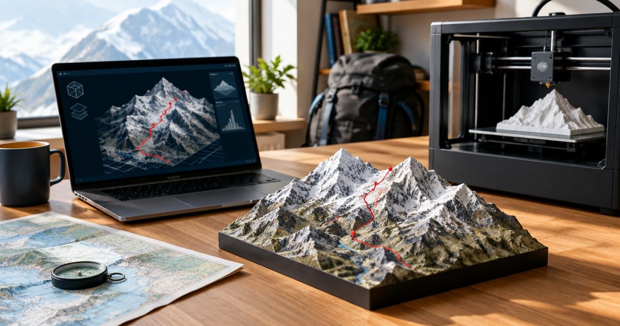
Yes. A route-based topographic sculpture combines the horizontal path of a crossing with the physical relief of the landscape. Your route identifies the hike; the terrain gives the canyon its shape.
The practical workflow is to identify the correct activity, inspect its track, choose the terrain coverage, and review the proposed result before printing. A GPX file is an input to that process, not a finished printer file.
Choose what the map should represent
| Map approach | Best for | Main advantage | Main limitation |
|---|---|---|---|
| Recorded hike with surrounding terrain | A finisher commemorating a completed crossing | Connects the sculpture to the actual activity | Recording errors or missing sections need attention |
| Planned route with surrounding terrain | Someone representing an intended crossing | Defines the intended trail before the hike | Does not document what the hiker ultimately completed |
| Terrain without a personal route | Someone who wants a landscape model | Keeps attention on the canyon’s landforms | Does not identify a particular crossing |
For a completed-hike keepsake, choose the recorded hike with surrounding terrain. Use a planned route only when that is what you intend to commemorate. Neither choice should be presented as the other.
A landscape model and a personal route sculpture answer different questions. One shows a place. The other shows your relationship to that place.
Recorded hike: best for commemorating your crossing
A completed GPS activity is the strongest starting point for a personal rim-to-rim keepsake because it represents the route you recorded. Check it against your memory of the hike before submitting it.
Look for a recording that starts at the intended trailhead and ends at the intended finish. A track that continues into a parking area or includes a drive afterward needs a different review from a clean trailhead-to-trailhead activity.
Keep meaningful detours if they belong to the story. Remove accidental recording only after deciding what the sculpture should represent. A keepsake of the entire day and a keepsake of the crossing are not necessarily the same design.
For a 2026 crossing, verify the activity date as well as the route. A similarly named training hike is easy to confuse with the milestone activity when browsing saved files.
Planned route: best for representing an intended hike
A planned route works when you want to show a specific intended crossing rather than document a finished activity. It is also a useful reference when comparing a recorded track with the path you meant to follow.
The limitation is straightforward: a planned line cannot establish what someone actually hiked. Do not label it as their recorded route unless you have confirmed that it matches.
If you are buying a surprise gift, ask for the trailheads and crossing direction before choosing the file. You can keep the gift itself a surprise without guessing which hike matters.
For a post-hike gift, prioritize the recipient’s completed route over a generic rim-to-rim file. The route’s personal relevance comes from the crossing it represents, not merely from having Grand Canyon in its name.
Terrain model: best for showing the canyon’s shape
The terrain model supplies the surrounding surface that a route track alone does not describe. It gives the physical object its ridges, slopes, and canyon relief.
A GPX track can contain elevation samples along the path. Those samples still do not describe every slope on either side of the trail. That is why route elevation and landscape relief are related but separate parts of the design.
Terrain-only models work as landscape objects, but they leave out the personal crossing unless a route is added. If the purpose is to celebrate a finisher, the route should remain identifiable rather than becoming incidental to the landscape.
How do you prepare a rim-to-rim route for printing?
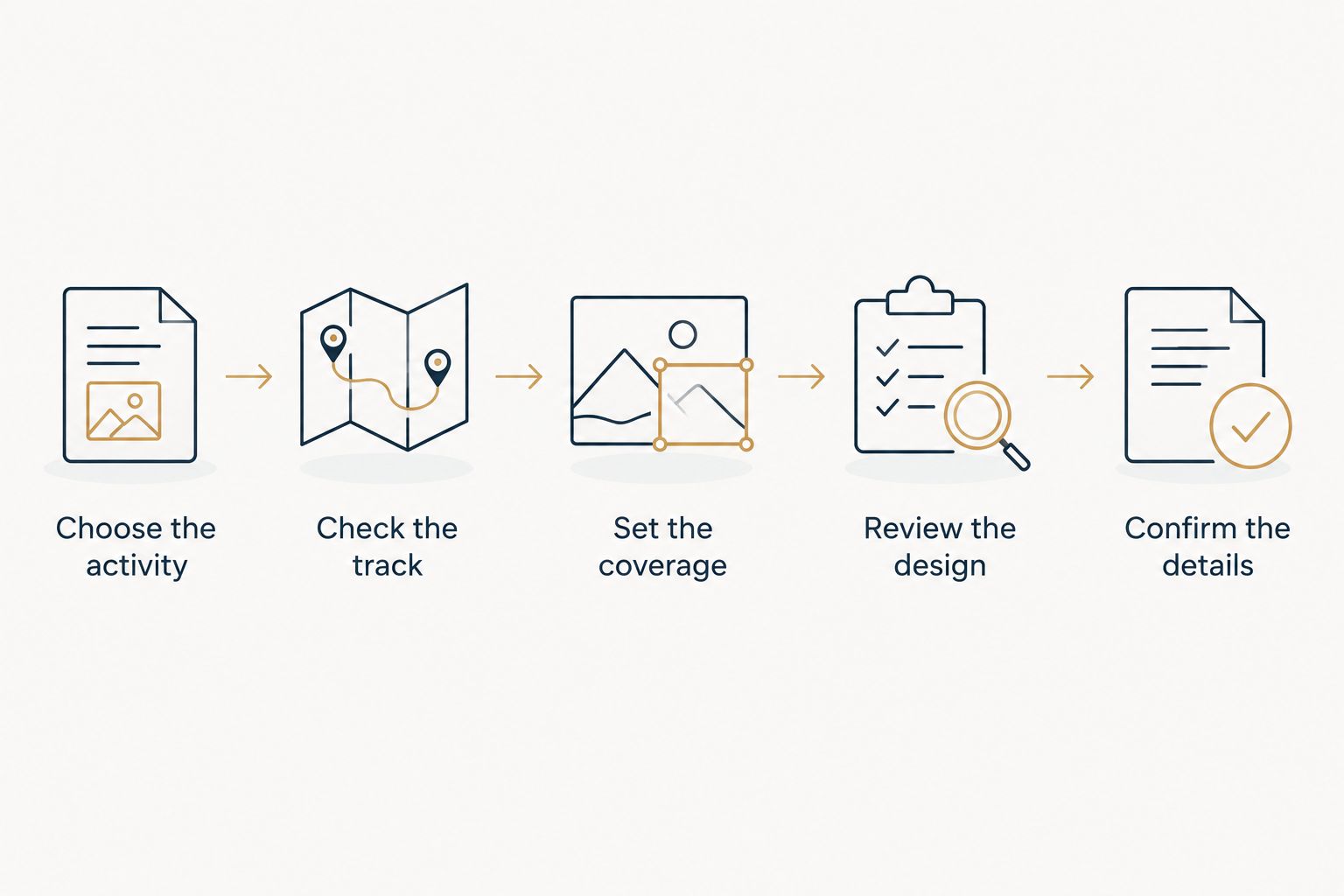
Prepare the route in a deliberate sequence. Resolve file and route questions before focusing on optional wording or presentation.
- Choose the activity. Find the completed crossing or the planned route you intend to represent. Confirm which one it is.
- Check the track. Inspect the start, finish, gaps, and any points that jump away from the trail. Compare questionable sections with the intended path.
- Set the coverage. Decide whether the model should emphasize the route corridor or include more surrounding canyon terrain.
- Review the design. Check that the route remains legible against the terrain. If a preview is available, inspect the whole crossing rather than only the most dramatic section.
- Confirm the details. Verify any requested wording, hike date, and route description before approving production.
The order matters. A correct date cannot fix the wrong crossing, and attractive terrain cannot fix a track that includes the journey home.
What should you check in a GPX file?
Open the track in a map viewer and follow it from start to finish. Look for an unexpected straight line across terrain, a missing section, or a cluster of points away from the intended path. Treat those as inspection flags, not proof that the whole file is unusable.
Keep an unchanged copy of the original recording before editing anything. That gives you a reference if a corrected version removes a detour you wanted to preserve.
Check the source track before judging the sculpture’s accuracy. A faithful rendering of an incorrect input still produces the wrong keepsake. The guide to GPS-based map accuracy covers that distinction in more detail.
Why the finished rim-to-rim map varies
Different source files and presentation choices produce different objects, even when every design represents a Grand Canyon crossing. Focus your review on these factors:
- Route selection. Different trailheads and trail combinations change the line that the sculpture needs to show.
- Track completeness. A recording that stops early does not document the missing section. Establish how that section will be represented before approval.
- Terrain coverage. A wider landscape includes more context; a tighter crop gives the route more visual emphasis at the same display size.
- Vertical scaling. Ask whether vertical relief uses the same scale as horizontal distance or is exaggerated for visibility.
- Route visibility. The line needs to remain distinguishable where the path crosses complex terrain or turns tightly.
- Personal details. If the design includes a date or wording, those details must match the intended hike.
For a 2026 order, turn these factors into approval questions rather than assuming every maker uses the same approach. Ask what the design represents and what has been simplified.
A display sculpture is not a substitute for a navigation map. Its purpose is to commemorate the crossing; your hiking plans require current route and safety information from appropriate park sources.
Where does Printmyroutes fit?
Printmyroutes is best for hikers who want a custom topographic route sculpture made from a GPX upload or Strava activity. That matches the goal of turning a completed canyon crossing into a physical keepsake.
The limitation is the input: a personalized route sculpture still needs the correct activity. Before ordering through Printmyroutes, identify the crossing and decide which parts of the recording belong in the finished object.
Ask about any requirements that matter to your gift, including the terrain boundary, route treatment, and requested personalization. Confirm those details rather than treating a reference image or general product description as an order-specific promise.
Start with your canyon route
Choose the GPX file or Strava activity that represents the crossing you want to commemorate.
Do you need your own GPX file?
You do not need a GPX file specifically if you have a usable Strava activity for a service that accepts it. Printmyroutes accepts GPX uploads or Strava as sources for custom route sculptures.
The important requirement is a route that represents the intended crossing. If you have neither, establish what route source will be used before ordering; do not assume a generic file matches the recipient’s hike.
Should you use the outbound route or the whole activity?
Use the portion of the activity that matches the milestone you want to commemorate. A rim-to-rim crossing and a longer outing that includes additional travel tell different stories.
For a 2026 finisher gift, ask the hiker what they consider the start and finish of their achievement. Then check that the submitted track uses those boundaries.
Can you order a sculpture before the hike?
Yes, a planned route can represent an intended hike, but it cannot document a completed crossing. If the gift is meant to celebrate the finish, wait until you can verify the completed route.
You can prepare earlier by confirming the intended trailheads and asking how the hiker records activities. Keep the final route decision tied to the hike itself.
FAQ
Can you 3D print a map of Grand Canyon rim to rim?
Yes, you can 3D print a Grand Canyon rim-to-rim map by combining the route with a printable terrain model. A personal keepsake should use the intended crossing rather than an unrelated canyon track.
Can I send a GPX file straight to a 3D printer?
No, a GPX file is not a finished printer file. Its route data must be incorporated into a printable model and prepared for the printer.
Does a GPX file include the canyon terrain?
A GPX track does not describe the entire surrounding canyon surface. Even when it contains elevation samples along the route, a topographic sculpture needs terrain data beyond that line.
Can I use Strava instead of uploading a GPX file?
Yes, Printmyroutes accepts Strava as a source for custom topographic route sculptures. Choose the activity that represents the crossing you want to commemorate.
What if my watch stopped recording during the hike?
A partial recording does not document the missing portion of the crossing. Identify the gap and agree on how it will be represented before approving a design.
Is a planned route good enough for a finisher gift?
A planned route is appropriate only if it matches what the gift is meant to represent. For a completed-hike keepsake, confirm the actual crossing rather than assuming the plan and activity are identical.
Can I use a printed terrain sculpture to plan the hike?
A commemorative terrain sculpture is not a substitute for current navigation and safety information. Use appropriate park guidance and hiking maps when planning a crossing.
One last thing
Before approving a 2026 keepsake, trace the route from the starting rim to the finishing rim without relying on its filename. Check both endpoints, then look for anything recorded before or after the crossing.
The easiest error to overlook is not the canyon’s shape. It is choosing a familiar-looking file that represents the wrong day, direction, or activity.