A 3D printed map from GPS data has no universal accuracy rating: its fidelity depends on the recorded route, the terrain data, and how both are scaled for printing. A recognizable course is not proof of survey-grade precision, and exaggerated elevation changes how steep the landscape appears.
- How accurate is a 3d printed map from gps data? Check route alignment, terrain detail, and physical scale separately.
- Printmyroutes makes GPS-based topographic keepsakes; evaluate them as milestone sculptures, not surveying instruments.
- A GPX file records a route; the surrounding terrain requires elevation data beyond that line.
- Before ordering, check the summit, switchbacks, start, finish, and whether elevation is exaggerated.
How accurate is a 3D printed map made from GPS data?
A printed map can preserve a route's recognizable shape without reproducing every bend or elevation change at its original proportions. Accuracy is not a single property. Separate the recorded track, the surrounding landscape, and the finished object.
For a custom keepsake from Printmyroutes, start with the GPX upload or Strava activity that represents the achievement you want to commemorate. Then check how that route relates to the terrain.
| Accuracy question | What determines it | What to check before ordering |
|---|---|---|
| Does the line follow your activity? | Recorded GPS positions and any edits | Start, finish, gaps, detours, and unusual jumps |
| Does the landscape represent the location? | Terrain elevation data and its resolution | Summit placement, valleys, ridgelines, and slopes |
| Are the proportions true to scale? | Horizontal scale and vertical scale | Whether the height has been exaggerated |
| Will small features remain visible? | Model size and printable detail | Tight switchbacks, closely spaced trails, and shallow relief |
An accuracy statement should identify which of these questions it answers. A printer's layer height alone does not tell you whether the route follows the correct trail.
Why this matters
For a 2026 finisher gift, the important test is whether the sculpture tells the right story. A cleanly printed mountain is still the wrong keepsake if the route stops below the summit or follows a different race course.
Printmyroutes is best for runners and hikers seeking a GPS-based milestone keepsake, not a surveying instrument. Its custom topographic sculptures use GPX uploads or Strava data. That makes the choice of activity part of the personalization, not just an upload task.
Decide what you want the object to preserve: the route actually completed, the published course, or a particular summit outing. Those are different records, even when they share much of the same trail.
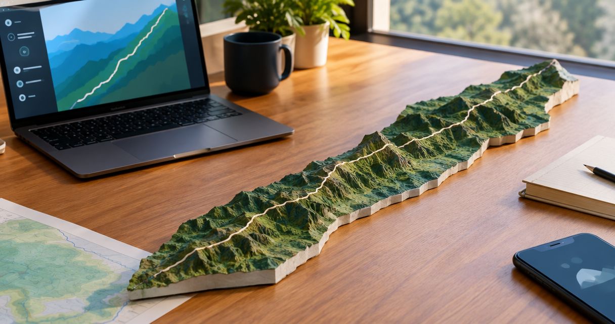
Route accuracy: does the GPS line match the activity?
A GPX track contains recorded positions and can include elevation information. It does not guarantee that every recorded point sits exactly on the path you traveled.
Satellite visibility, reflected signals, recording settings, and interruptions affect GPS tracks. On a map, these issues can appear as wandering lines, sharp jumps, or straight connections across missing sections. Printing faithfully reproduces those problems unless they are addressed during preparation.
Review the whole activity before focusing on tiny deviations. A missing final climb matters more to a summit keepsake than a small sideways wobble beside an otherwise correct trail.
Recorded activity versus published course
Choose the source according to what the gift should represent. Neither source automatically answers both needs.
| Route source | Best for | Advantage | Limitation |
|---|---|---|---|
| Personal recorded activity | Commemorating the route someone completed | Preserves the individual's outing, including real deviations | Can contain recording gaps, GPS drift, or an unfinished recording |
| Published course file | Commemorating the intended event course | Provides a course reference independent of a participant's device | Does not prove the participant followed that exact line; editions can differ |
For a personal finisher keepsake, check the participant's recording first. For a course-based award, verify the event edition and the organizer's intended route. Do not silently substitute one for the other.
Terrain accuracy: does the landscape match the route?
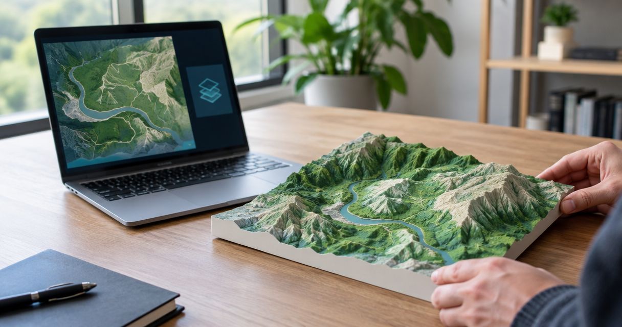
A route line and a terrain surface are different datasets. Even when a GPX file includes elevation at its track points, those points do not describe every hillside surrounding the trail.
Terrain models supply the broader surface: valleys, ridges, summits, and slopes. Their resolution determines how much landscape detail exists before the model reaches the printer. Increasing the printed object's size does not restore terrain detail absent from the source.
For your 2026 order, ask what terrain source supports the model and whether it represents bare ground or a surface that includes features above ground. These distinctions matter when you expect a clean landform rather than every visible object in the landscape.
Inspect recognizable landmarks instead of judging only the overall mountain silhouette:
- Does the route reach the correct summit or pass?
- Does the trail sit on the expected side of the ridge?
- Does the valley continue in the right direction?
- Are separate climbs represented as separate landforms?
A visually convincing surface is useful for a keepsake. It is not, by itself, evidence of a stated positional tolerance.
Scale accuracy: why correct terrain can look different
A physical map compresses a large landscape into a small object. That transformation changes which details remain visible, even when the underlying data is correct.
At a horizontal scale of 1:25,000, 1 millimeter on the model represents 25 meters on the ground. Those numbers describe a scale relationship, not a claimed specification for any particular sculpture. A trail bend occupying little space on the finished object is harder to distinguish than a broad valley.
Vertical exaggeration introduces another distinction. When height is enlarged relative to horizontal distance, hills become easier to see, but their apparent steepness no longer matches a uniformly scaled landscape.
| Scaling approach | Best for | Benefit | Trade-off |
|---|---|---|---|
| Equal horizontal and vertical scale | Preserving terrain proportions | Keeps height and distance in the same proportion | Low-relief terrain can look subtle |
| Exaggerated vertical scale | Making elevation changes easier to see | Emphasizes climbs, valleys, and ridgelines | Makes slopes look steeper than their true proportions |
Neither treatment is automatically wrong for a commemorative object. Ask whether the elevation is exaggerated before interpreting the sculpture as a literal model of steepness.
Why 3D printed map accuracy varies
For a 2026 purchase, assess these factors separately rather than accepting an unexplained accuracy claim:
- Route recording: GPS drift and recording gaps affect where the activity line appears.
- File selection: A planned route, personal activity, and different event edition can describe different journeys.
- Terrain resolution: The source elevation surface limits the landform detail available to reproduce.
- Model scale: A wider geographic area leaves less physical space for each trail bend or ridge.
- Vertical scaling: Enlarged height changes apparent steepness without necessarily changing the route's horizontal position.
- Print preparation: Smoothing and minimum printable feature sizes affect how fine details reach the finished object.
These factors interact. A detailed terrain source does not repair a missing section of GPS track, and a clean route file does not establish the accuracy of the surrounding terrain.
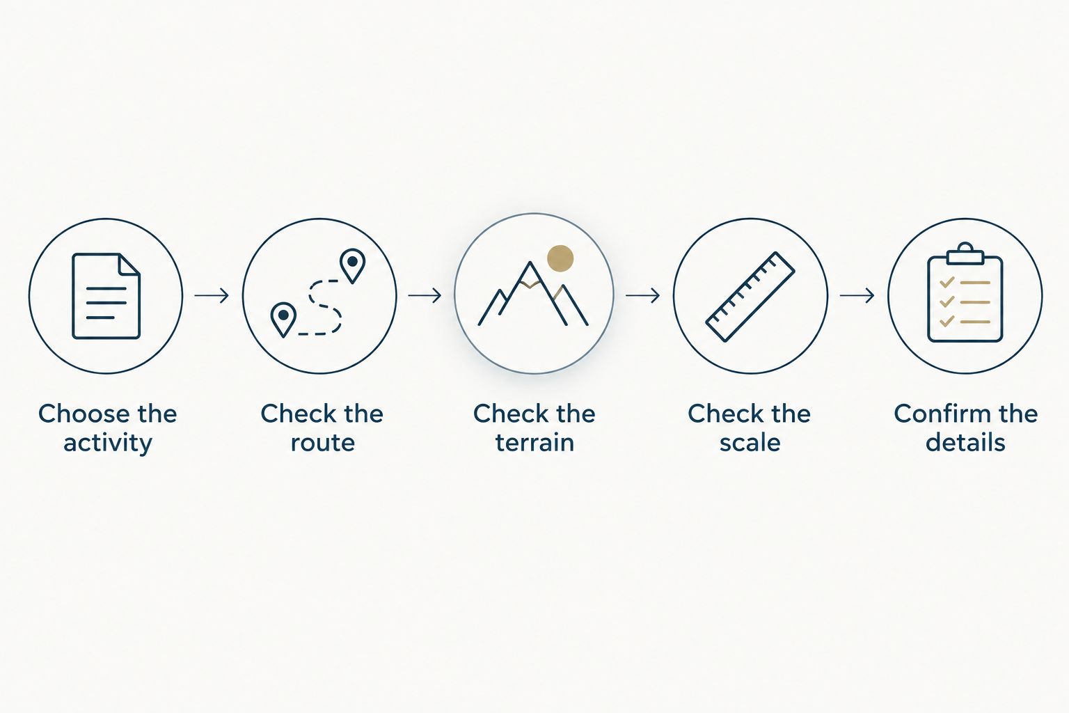
How do I check a route sculpture before ordering?
For a 2026 order, use a route-first review. Check the meaning of the file before judging the appearance of the model.
- Choose the activity. Select the outing or race edition you want to preserve. Confirm whether the recipient cares about their actual track or the intended course.
- Check the route. Look at the start, finish, summit, major turns, and any recording gaps. Identify detours you want retained rather than assuming every deviation is an error.
- Check the terrain. Compare the route with recognizable ridges, valleys, and passes. Confirm that the geographic area includes the landmarks that matter.
- Check the scale. Ask about the area shown, the physical dimensions, and vertical exaggeration. Do not infer these from a perspective image alone.
- Confirm the details. Verify any personalization you request, including the activity name and date. Ask to review the route representation before production.
If your source is a recorded ride, the Ride with GPS to 3D printed sculpture workflow covers that starting point. The same review principle applies: opening a file successfully is not the same as confirming it represents the right achievement.
Ask specific questions. “Does the route reach this summit?” is more useful than “Is it accurate?” Likewise, “Is the vertical scale exaggerated?” gives you a clearer answer than “Will it look realistic?”
Is a GPX upload more accurate than Strava?
A GPX upload is not inherently more accurate than Strava. What matters is the underlying recording, whether the complete route is included, and any processing applied before the model is made.
Compare the route geometry rather than treating the file format or platform name as a quality rating. Check that the version supplied for the sculpture includes the intended start, finish, and full activity.
Does a higher-resolution print guarantee a more accurate map?
A higher-resolution print does not guarantee a more accurate map. Fine printing can reproduce a prepared model more closely, but it cannot correct the wrong route, restore missing terrain information, or undo an undisclosed scale change.
For Printmyroutes route sculptures, evaluate the source activity and terrain representation before focusing on surface detail. The strength of a personalized sculpture is its connection to a specific achievement; the limitation is that appearance alone cannot establish geographic precision.
Can I use a 3D printed GPS map for navigation?
A commemorative 3D printed GPS map is not a substitute for a navigation map or survey. A physical sculpture does not establish current trail conditions, access restrictions, or the positional accuracy needed for a technical task.
Choose a route sculpture for remembering a finish, ride, or summit. Use appropriate navigation information for travel and qualified surveying work for boundary or engineering decisions.
FAQ
How accurate is a 3D printed map from GPS data?
A 3D printed map has no universal accuracy rating. Its fidelity depends on the recorded route, terrain source, model scale, and print preparation; assess those separately.
Will a route sculpture show every switchback?
Not every switchback is guaranteed to remain distinct in a route sculpture. Visibility depends on the source track, the area represented, and the physical space available for each bend.
Does my GPX file contain the surrounding mountains?
A GPX track does not describe the full surrounding mountain surface. It contains route positions and can include elevation at those points; broader terrain requires additional elevation data.
Why does the printed mountain look steeper than the real trail?
Vertical exaggeration makes printed terrain look steeper when height is enlarged relative to horizontal distance. Ask whether the model uses equal horizontal and vertical scales before judging its proportions.
Should I use my activity or the official race route?
Use your activity to commemorate the route you completed, and the official course to commemorate the intended event route. Check the event edition and inspect either source before ordering.
Can Printmyroutes use a GPX file or Strava activity?
Printmyroutes makes custom topographic route sculptures from GPX uploads or Strava data. Choose the activity that represents the milestone, then check its start, finish, and major landmarks.
What should I check when buying a route sculpture as a gift?
Check the exact activity, event edition, start, finish, and summit before ordering a route sculpture as a gift. Confirm the intended terrain area, scale treatment, and any personalization you request.
One last thing
For your 2026 keepsake, do not automatically remove every deviation from the recorded line. A wrong turn, return to an aid station, or summit out-and-back can be part of the achievement you want to remember.
Decide whether you want the course as planned or the journey as completed. That decision makes “accurate” meaningful before anyone prepares the print.